File:Tenebrio molitor MHNT.jpg

Size of this preview: 420 × 600 pixels. Other resolutions: 168 × 240 pixels | 336 × 480 pixels | 538 × 768 pixels | 717 × 1,024 pixels | 1,434 × 2,048 pixels | 3,183 × 4,545 pixels.
Original file (3,183 × 4,545 pixels, file size: 3.06 MB, MIME type: image/jpeg)
Summary
|
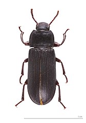
Tenebrio molitor (Linnaeus, 1758) | |||||||||||||||||||||||||||||||||||||||||||
|
| |||||||||||||||||||||||||||||||||||||||||||


Published in the press
File history
Click on a date/time to view the file as it appeared at that time.
| Date/Time | Thumbnail | Dimensions | User | Comment | |
|---|---|---|---|---|---|
| current | 08:18, 31 July 2011 | | 3,183 × 4,545 (3.06 MB) | Archaeodontosaurus | {{Information |Description ={{en|1=x}} |Source ={{own}} |Author =Archaeodontosaurus |Date = |Permission = |other_versions = }} |
File usage
The following 4 pages use this file:
Global file usage
The following other wikis use this file:
- Usage on ar.wikipedia.org
- Usage on arz.wikipedia.org
- Usage on be.wikipedia.org
- Usage on bg.wikipedia.org
- Usage on bs.wikipedia.org
- Usage on ca.wikipedia.org
- Usage on ceb.wikipedia.org
- Usage on cs.wikipedia.org
- Usage on da.wikipedia.org
- Usage on de.wikipedia.org
- Usage on en.wikipedia.org
- Coelus
- List of subgroups of the order Coleoptera
- Coelus globosus
- Coelus gracilis
- Polposipus herculeanus
- Flour beetle
- Tenebrioninae
- Destructive flour beetle
- Cossyphus
- Lobopoda
- Itagonia cordiformis
- Alobates pennsylvanica
- Opatrini
- Trachelostenus
- Asida (beetle)
- Homotrysis
- Nalassus dryadophilus
- Template:Tenebrionidae-stub
- Stenocara dentata
- Eutermicola
- Isomira
- Alleculinae
- Accanthopus
- Gonocephalum assimile
- Gonocephalum
- Helops
- Eleodes osculans
- Homala integricollis
- Homala
- Adelium
- Lagria
- Cteniopus
- Pimeliinae
- Sepidium magnum
- Sepidium
- Nalassus
- Paivaea
- Lagria cuprina
- Mesostena puncticollis
- Mesostena
View more global usage of this file.